


Forgive Jeff Kish for his unabashed optimism about the little-known Pacific Northwest Trail (PNT), a 1,200-mile trek from the Continental Divide to the Olympic coast.
Kish, Pacific Northwest Trail Association executive director, wants to start fulfilling the vision of a fully non-motorized route as designated by Congress 14 years ago.
The chance to make headway got a boost when the U.S. Forest Service announced on Dec. 12 the completion of a comprehensive plan. Federal officials describe the 290-page document as a blueprint for developing a route currently facing mountains of challenges.
To wit: 40% — 480 miles — of the PNT follows gravel or paved roads. Many of those sections are forest service logging roads that might remain in place for decades.
Kish said hikers have asked why the route has so many roads, too few signs and includes crossing private property, although the first thru-hikers accomplished the feat in 1977.
“The answer to all those questions is we’ve been prohibited from moving forward with these projects without a comprehensive plan,” he said. “So that’s why it is a big deal for us to have this plan.”
The document is an umbrella for guidance, recommendations and tools to analyze future site-specific trail projects, said Tracy Calizon of the U.S. Forest Service.
About 80% of the trail crosses public land, including seven national forests, three national parks and state holdings. The other 20% includes tribal and private timber lands.
Specific upgrades, reroutes and land acquisitions will involve local agencies. The forest service serves as the designated administrator to help facilitate decisions by local managers.
“We really want the plan to function as a cohesive vision across that 1,200-mile-plus length,” said Calizon, assistant director for recreation for the Pacific Northwest Region of the forest service.
Perhaps in 20 years or more, the route might enjoy a similar cachet as the Appalachian, Continental Divide and Pacific Crest trails. They are considered the Triple Crown of the National Scenic Trails system.
Patience is the operating word. The Appalachian Trail took 16 years to complete; the PCT, a quarter of a century. The 3,100-mile Continental Divide Trail is about 70% finished, although Congress designated it as a scenic route in 1978.
The PNT became the 11th addition to the system in 2009. And yet only now have stakeholders reached the point where they can start prioritizing projects.
Conservation carries equal weight to recreation for trails within the National Scenic system. As a result, environmental considerations to ensure sustainability will be vital to the trail’s completion.
“Any change we’re going to make on the trail is subject to environmental processes,” Kish said.
Interpretation: Upgrades will take longer while going through necessary, albeit time-consuming, environmental policy assessments.
The approach is all the more important as the effects of climate change have added challenges to maintaining long-distance wilderness trails.
“The plan really gives us a lot of ability to adapt and change over time if things do occur,” said Rick Pringle, the forest service’s acting PNT administrator.
By clearing the first big bureaucratic hurdle, trail promoters hope to tap into federal resources and funding to start addressing the issues of a thru-hike that attracts about 80 people a year.
Federal officials estimate the route can handle between 552 and 1,748 thru-hikers annually without causing environmental degradation. But a surge of users might force local land managers to introduce a permit system like the PCT.
The 2,660-mile PCT from Mexico to Canada had almost 520 finishers this year despite record snow along the route in California’s Sierra Nevada Mountains.
Should government officials earmark public resources for 80 thru-hikers? Those disapproving of the idea miss the point.
The places needing improvements already see heavy use from day hikers, mountain bikers and horseback riders. Developing the PNT could be a boon for Whatcom and Skagit County outdoor enthusiasts who have no interest in overnight trips.
The Interstate 5 corridor in Bellingham’s sphere is the trail’s most developed section.
“That is where we have the most private land,” said Kish, who lives in Sudden Valley. “That is where we are going to have the biggest challenges.”
The trail leaves North Cascades National Park via Hannegan Pass. It puts hikers on Mount Baker Highway (um, no thank you) to Heather Meadows before heading off-road to Baker Lake.
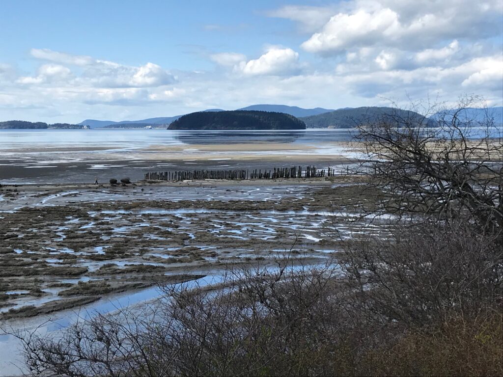
The route includes passing Anderson Mountain and Alger Alp on the south side of Lake Whatcom before crossing I-5 to reach Blanchard Mountain.
Trekkers eventually walk along Chuckanut Drive into Skagit’s fertile agricultural hub where most of the trail follows narrow farm roads and state Route 20 until Anacortes.
No one would be blamed for avoiding this section — except for a detour to the Breadfarm in Edison.
While paved roads are the most pressing issue, PNT administrators also want to get the route off private land.
The first step is to build an inventory of the land they need to acquire. From there, Kish said his group wants to develop relationships with property owners and local land trusts to be in position to strike deals when parcels become available.
Whatcom and Skagit counties have many large landowners, so the trail association isn’t dealing with 200 people controlling half-acre parcels.
“To complete the trail, we’re talking about maybe some land swaps or purchases from timber companies where you can purchase miles and miles in one sale,” Kish said.
The Pacific Northwest Trail Association and federal agencies can’t do much until an owner is willing to sell.
With so much of the route needing rerouting and upgrading, it’s easy to overlook why Ron Strickland conceived the idea of the PNT in 1970.
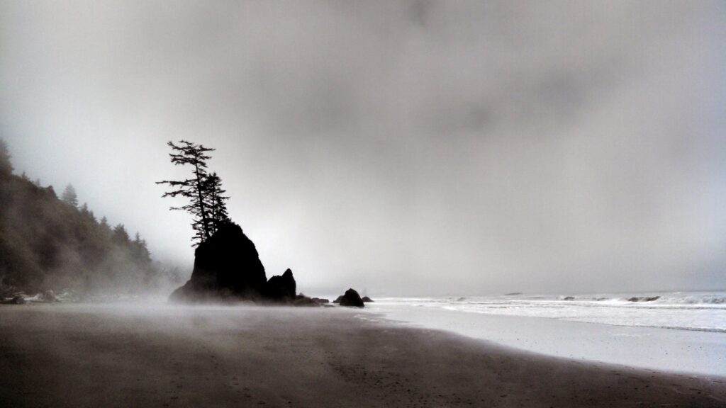
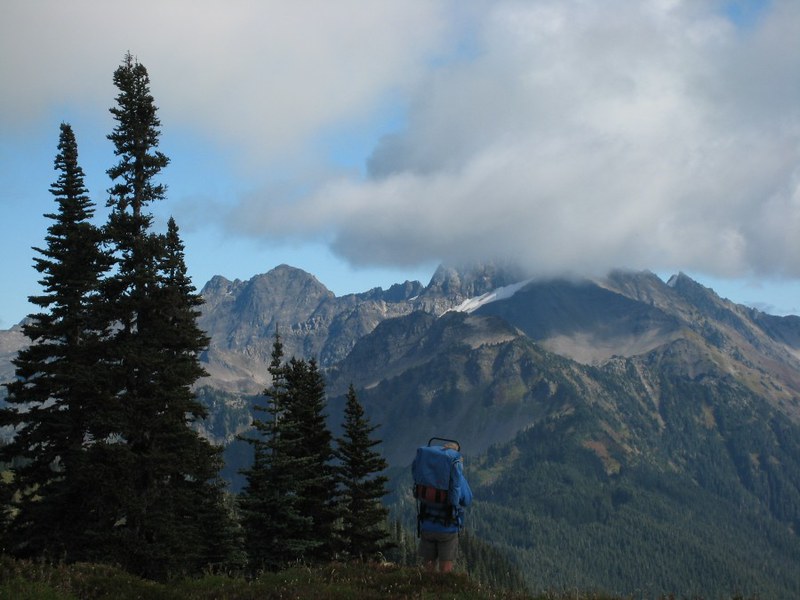
The only east-west route in the trails system passes some of America’s most awe-inspiring scenery, starting in glacially sculpted Glacier National Park and ending on the wind-swept Olympic coast next to emerald rainforests.
“A visitor on one of these trails gets a profound experience, creates lasting memories and instills a stewardship ethic,” the forest service’s Calizon said.
They also experience some of the wildest terrain in the Lower 48.
Until they hit the pavement, that is.
Elliott Almond’s outdoor column appears monthly. Email: elliottalmond4@gmail.com.


